TAG HOUSTON

Introduction to the Motion Map

Private and public sector cooperation are essential for successful transportation projects and require an organization that can bridge potential divides and lead with a united voice. Advancing mobility improvements is a core value of TAG, today and for the future.

City Map

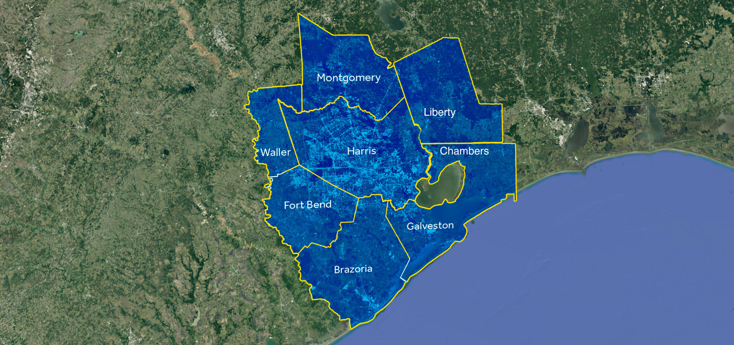
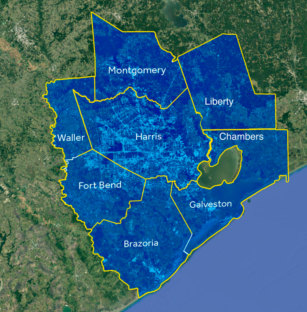
What does the Motion Map represent?

The Motion Map represents the numerous transportation projects planned and necessary for the growing Greater Houston Region

highway

What is featured on the Motion Map?

The map illustrates highway projects, toll projects, high-capacity transit projects, high speed rail, freight projects, other mobility considerations and future studies. All projects are in various stages, funded and unfunded.

Question Mark

Why is it necessary?

The Motion Map gathers transportation proposals in one place illustrating the numerous mobility projects requiring funding for the Houston Region. This map is central to TAG’s core mission to secure funding that supports infrastructure for all modes of Transportation designed to improve connectivity and quality of life for our entire community.
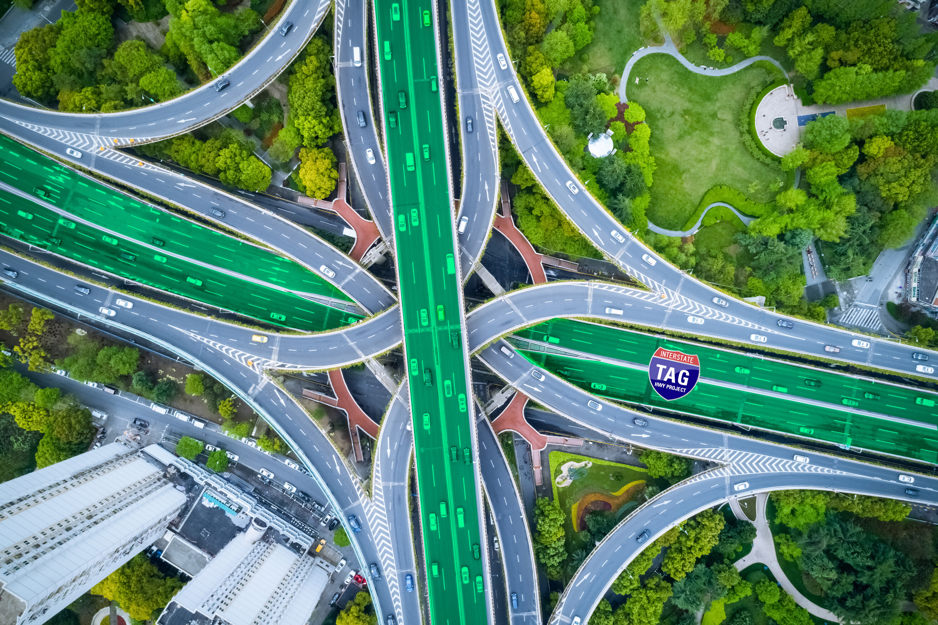
MOTION MAP

Counties Represented on Motion Map

TAG is dedicated to building a broad-based coalition of businesses, local governments, and community organizations to demonstrate public support for full and adequate funding of transportation infrastructure by the local, state, and federal governments. Counties represented in the Greater Houston Region include Brazoria County, Chambers County, Fort Bend County, Galveston County, Harris County, Liberty County, Montgomery County, and Waller County.

MOTION MAP

Demographics

Houston-Galveston Area Council - 2045 Regional Transportation Plan Demographics

The eight-county Houston region has experienced dramatic changes in its population size and composition over the last few decades, and these trends are expected to continue. Where these new residents will live and work, as well as how they will travel in the region depends largely on the transportation system choices available to them.

According to the 2015 US Census, the region had 6.54 million residents and 3.2 million jobs. By 2045 the region is expected to add 4.2 million more people for a total of 10.76 million residents. That represents an increase of roughly 1.5 percent growth annually. Similarly for jobs, the region is expected to create an additional 1.6 million jobs for a total of 4.8 million.

MOTION MAP

Rail Facts & Figures

0
at grade crossings in Houston Beaumont Study Area
0 +
miles of track owned by Class 1 railroads
0
million tons move through TxDOT Houston District (2018)

MOTION MAP

Projects Featured on Motion Map

Highway Projects

Projects which provide for the design, construction, improvement, or enhancement of a public road, including bridges, culverts, or other appurtenances related to public roads, either on or off the state highway system. The motion map includes:

Unfunded Projects
Funded Projects
Under Construction Projects

High-Capacity Transit Projects

High-capacity transit refers to a bus or rail vehicle that operates along an exclusive or semi- exclusive route with faster overall travel speeds than if in mixed traffic.

High Speed Rail

The development, design, construction, finance, and operation of the innovative new high-speed passenger train line that will connect the fourth and fifth largest economies in the country, North Texas and Greater Houston, in less than 90 minutes, with one stop in the Brazos Valley.

Freight Projects

Freight projects focus on improving and facilitating transportation of goods that travel via trucks and railroads. These projects might also include grade separations that eliminate the interface of trains and passenger vehicles.

PEL Studies

PEL (Planning and Environmental Linkage) is a study process that identifies transportation issues, priorities, and environmental concerns. It can be applied to make planning analyses and decisions that help define and prioritize future projects and clarify their purpose and need, particularly around the environment.

Toll Projects

Toll roads charge a fee when the user passes a collection point. Payment in the Houston region is primarily through electronic methods enabling vehicles to enter and exit without stopping the vehicle.

Other Mobility Considerations

This category includes additional opportunities for travel options, such as bicycle paths and unique infrastructure improvements.

The Gulf Coast Rail District (GCRD) is a political subdivision of the State of Texas created to enhance the economic benefits of rail and passenger transport while improving regional quality of life. Harris County, the City of Houston, and Fort Bend County along with Port Houston created the Gulf Coast Rail District under authority granted by the State of Texas in Section 171 of the Transportation Code.

Houston Area Rail Transformation (The HART)

The Greater Houston region is developing a collaborative and programmatic approach called The HART to leverage private and public funding opportunities for railroad projects in the region. The basis for this approach stems from the 2021 Houston-Beaumont Region Freight Study issued by the Texas Department of Transportation (TxDOT), which provided the initial working list of projects for consideration. The HART operates as a committee of Gulf Coast Rail District and is comprised of the region’s counties, HGAC, TxDOT, the City of Houston, and the Class 1 and other railroads.

Connect Smart is the only mobile app powered by live data from local transportation authorities to provide the most accurate traffic information available. It works with local transportation companies like B-Cycle and METRO to schedule a trip, buy a ticket or even find an available e-bike nearby and throughout Harris, Montgomery, Liberty, Chambers, Galveston, Brazoria, Fort Bend and Waller counties. Whether you are a driver, a bus or light rail rider, a cyclist, a carpooler, or all the above, ConnectSmart provides tailored suggestions to improve personal travel.  ConnectSmart is compatible with Android and Apple phones. Download the app from Google Play and the Apple App Store.
Port Houston is a strategic leader for the Houston Ship Channel and is instrumental in the region’s development for international trade. Port Houston owns, manages, and operates eight public terminals along the 52-mile waterway, including the area’s largest breakbulk facility and two of the most efficient container terminals in the country.